
Lighthouse Route Nova Scotia: The Ultimate South Shore Road Trip (Map & Stops)
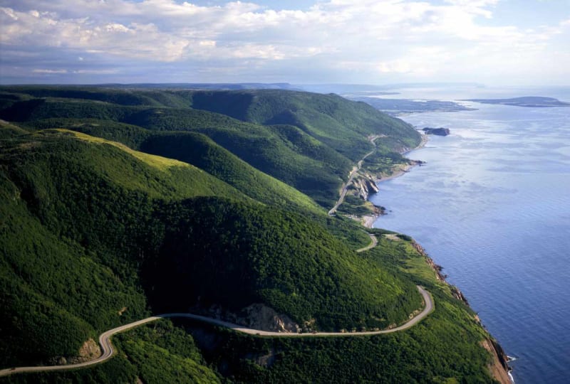
Quick Summary: Hugging Nova Scotia’s rugged Atlantic coast from Halifax to Yarmouth, the Lighthouse Route is one of Canada’s classic coastal road trips. Winding past over 20 historic lighthouses, colourful UNESCO towns, white sand beaches, and seaside lobster shacks, this itinerary showcases the very best of the South Shore.
Route Overview & Map Flow
Day-by-Day Detailed Itinerary
Day 1: Halifax, Peggy’s Cove & Mahone Bay
- Driving Distance: 105 km (Route 333 & Route 3)
- Highlights: Depart Halifax along Highway 333. Arrive at Peggy’s Cove early morning to photograph Peggys Point Lighthouse and walk the viewing deck. Continue past coastal inlets to Chester (boating hub) and Mahone Bay (famous shoreline view of Three Historic Churches).
- Overnight: Mahone Bay or Lunenburg.
Day 2: UNESCO Lunenburg, Bluenose II & Blue Rocks
- Driving Distance: 40 km local South Shore driving
- Highlights: Spend a full day in Old Town Lunenburg (UNESCO World Heritage site). Tour the Bluenose II schooner docks, explore the Fisheries Museum of the Atlantic, and sample spirits at Ironworks Distillery. Drive 8 minutes east to the slate outcroppings of Blue Rocks for sea kayaking or photography.
- Overnight: Lunenburg.
Day 3: Liverpool, Carter’s Beach & Kejimkujik Seaside
- Driving Distance: 110 km (Hwy 103 & Route 3)
- Highlights: Drive south to Liverpool (historic privateer town). Spend the afternoon at Carter’s Beach—three coves of powder-white sand and clear turquoise water. Visit Kejimkujik National Park Seaside to hike coastal trails and view harbour seals basking on granite rocks.
- Overnight: Liverpool or White Point.
Day 4: Shelburne Historic Waterfront & Barrington Lobster Capital
- Driving Distance: 85 km (Route 3)
- Highlights: Drive to Shelburne to tour Dock Street—a preserved 18th-century Loyalist waterfront used as the film set for The Scarlet Letter. Continue to Barrington Passage (“The Lobster Capital of Canada”). Dine at Capt. Kat’s Lobster Shack and visit Cape Sable Island (Nova Scotia’s tallest lighthouse at 101 feet!).
- Overnight: Barrington or Pubnico.
Day 5: Acadian Coast, Cape Forchu Lighthouse & Yarmouth
- Driving Distance: 65 km
- Highlights: Explore the historic Acadian village of Pubnico (Le Village Historique Acadien de la Nouvelle-Écosse). Arrive in Yarmouth to tour Cape Forchu Lighthouse—an iconic “apple core” shaped lighthouse perched on rugged ocean bluffs. Board The CAT Ferry to Maine or loop back to Halifax via the Annapolis Valley.
Top Lighthouses to Spot Along the Route
- Peggys Point Lighthouse (Peggy’s Cove): Canada’s most famous white and red lighthouse.
- Cape Forchu Lighthouse (Yarmouth): Unique 19-metre “apple core” design with climbing access.
- Cape Sable Lighthouse (Barrington): Nova Scotia’s tallest lighthouse (31 metres / 101 feet).
- Fort Point Lighthouse (Liverpool): Historic 1855 lighthouse overlooking Liverpool Harbour.
- Cross Island Lighthouse (Lunenburg): Guiding ships into Lunenburg Harbour since 1832.
Where to Eat Along the Lighthouse Route
- Peggy’s Cove: Tom’s Lobster Shack, Sou’Wester Restaurant.
- Mahone Bay: Mateus Bistro, Rebecca’s Restaurant.
- Lunenburg: The South Shore Duck Tavern, Salt Shaker Deli, The Grand Banker.
- Liverpool / White Point: Elliot’s Dining Room (White Point Beach Resort).
- Barrington: Capt. Kat’s Lobster Shack (Famous deep-fried lobster rolls).
- Yarmouth: Rudder’s Seafood Restaurant & Brewpub.
Estimated 5-Day Lighthouse Route Budget (2 People)
| Expense Category | Estimated Cost (CAD) | Notes |
|---|---|---|
| Gasoline | $90 – $150 | ~340 km one-way driving + local exploration |
| Lodging (4 Nights) | $640 – $1,100 | Average $160–$275/night (Inns & Beach Resorts) |
| Dining & Seafood | $450 – $750 | ~$90–$150/day for two people |
| Museums & Tastings | $100 – $180 | Fisheries Museum, Ironworks, Cape Forchu |
| Total Trip Budget | $1,280 – $2,180 CAD | Complete 5-day South Shore experience |
FAQs
1. What is the Nova Scotia Lighthouse Route?
A famous scenic driving route along Nova Scotia’s South Shore (from Halifax to Yarmouth), passing over 20 historic lighthouses, UNESCO towns, white sand beaches, and fishing harbors.
2. How many days do you need for the Lighthouse Route?
4 to 5 days is ideal to explore Peggy’s Cove, Lunenburg, Carter’s Beach, Shelburne, Barrington, and Yarmouth without rushing.
3. What is Nova Scotia’s tallest lighthouse?
Cape Sable Lighthouse on Cape Sable Island (Barrington), standing 31 metres (101 feet) tall.
4. What is Nova Scotia’s most famous lighthouse?
Peggys Point Lighthouse at Peggy’s Cove.
5. What is the difference between Highway 103 and Route 3?
Highway 103 is the fast 100 km/h inland highway. Route 3 is the scenic coastal Lighthouse Route that winds directly through coastal towns and lighthouse turnoffs.
6. Where is Carter’s Beach located?
In Port Mouton, approximately 20 minutes drive south of Liverpool on the South Shore.
7. What is Barrington famous for?
Barrington is known as the “Lobster Capital of Canada” for hosting North America’s largest commercial winter lobster fishery.
8. What is Cape Forchu Lighthouse?
An iconic “apple core” shaped lighthouse located in Yarmouth, featuring climbing tours, walking trails, and a tea room.
9. What is The CAT Ferry?
A high-speed passenger and vehicle ferry operating between Yarmouth, Nova Scotia, and Bar Harbor / Portland, Maine (3.5 hours crossing time).
10. Can you drive the Lighthouse Route year-round?
Yes. Route 3 and Hwy 103 remain open and plowed year-round, though seasonal lobster shacks and museum tours operate primarily from May to October.
11. Are beaches on the South Shore free to visit?
Yes! All public ocean beaches (Carter’s Beach, Rissers Beach, Summerville Beach, Queensland) are 100% free with public parking.
12. Is the Lighthouse Route suitable for RVs?
Yes. Both Hwy 103 and Route 3 accommodate RVs and travel trailers easily, with campgrounds located at Rissers Beach, White Point, and Yarmouth.
13. What is the best month for this road trip?
July, August, and September offer warm weather, active patio dining, open lighthouse tours, and warm ocean beach days.
14. What nearby extensions can I add to this route?
Return to Halifax via the Annapolis Valley (Hwy 101) to create a complete 7-day Nova Scotia loop.
15. Where is the best seafood meal on the Lighthouse Route?
Try fresh lobster rolls at Tom’s Lobster Shack (Peggy’s Cove), deep-fried lobster at Capt. Kat’s (Barrington), and the Lunenburger at The Grand Banker (Lunenburg).
Related Guides & Internal Links
- Peggy’s Cove Complete Pillar Destination Guide
- Lunenburg UNESCO World Heritage Site Guide
- Halifax City Guide & Day Trips
- Nova Scotia 10-Day Ultimate Road Trip Guide
- The 15 Best Lobster Rolls in Atlantic Canada
Quick Facts
| Detail | Information |
|---|---|
| Location | Nova Scotia |
| Designation / Status | Key Destination / Regional Highlight |
| Area / Scope | Regional Highlight & Surrounding Coastline |
| Best For | Outdoor adventure, scenic drives, local dining, photography, road trips |
| Best Time to Visit | May–October |
| Ideal Visit | 2–4 days |
| Interactive Map Pin | [44.49,-63.91] |
Why Visit Nova Scotia Lighthouse Route Road Trip?
Unlike a single park or attraction, Nova Scotia Lighthouse Route Road Trip is an entire living landscape where nature, wildlife, and local maritime communities are deeply interconnected.
Highlights include:
- Scenic Coastal Vistas: Sweeping ocean views and rugged headlands.
- Outdoor Trails: Hiking, walking, and nature pathways.
- Historic Maritime Charm: Local culture, seafood dining, and coastal hospitality.
- Abundant Wildlife: Marine life, seabirds, and native wildlife species.
Insider Local Tip: Beat the Crowds: Visit popular lookouts and trailheads early in the morning (8:00 AM – 10:00 AM) or during late afternoon golden hour for optimal lighting and peaceful ocean views!
Top Places to Visit
1. Primary Coastal & Heritage Highlights
Explore the core natural and cultural landmarks that define Nova Scotia Lighthouse Route Road Trip.
Highlights:
- Walking along scenic coastal lookouts and boardwalks.
- Exploring local historical sites and heritage monuments.
- Sampling fresh Atlantic seafood at dockside restaurants.
- Photographing iconic lighthouses and ocean bluffs.
Best Hiking Trails
Popular options include:
| Trail Name | Distance & Duration | Difficulty | Key Highlights & Terrain |
|---|---|---|---|
| Coastal Headland Trail | 3.5 km (1.5 Hours) | Easy/Moderate | Coastal cliff walk with ocean lookouts. |
| Forest & River Trail | 4.2 km (2 Hours) | Moderate | Shaded Acadian forest path along river bends. |
| Summit Ridge Trail | 6.0 km (2.5 Hours) | Moderate | High elevation overlook with 360-degree vistas. |
Always check trail conditions before heading out.
Wildlife You’ll See
Depending on the season, visitors may encounter a rich variety of native species:
- Birds: Bald Eagles, Osprey, Great Blue Herons, Seabirds, and migratory songbirds.
- Marine Life: Harbour Seals, Minke Whales, Harbour Porpoises, and Atlantic Cod.
- Land Mammals: White-tailed Deer, Red Foxes, Snowshoe Hares, and Moose.
The combination of coastal waters, forests, and wetlands makes the region one of Atlantic Canada’s richest natural habitats.
Best Time to Visit
Spring (May–June)
- Rivers and waterfalls at peak flow.
- Wildflowers blooming in coastal valleys.
- Fewer crowds at major lookouts.
Summer (July–August)
- Warmest weather and pleasant ocean breezes.
- Coastal boat tours, high-tide kayaking, and beach swimming.
- Full festival and restaurant operating schedules.
Fall (September–October)
- One of the best seasons thanks to colourful forests, cooler temperatures, and excellent hiking.
- Seasonal harvest markets and fall foliage drives.
Winter (November–April)
- Quiet snowshoeing, winter photography, coastal ice formations, and cozy lodge retreats.
️ Suggested Day-by-Day Scroll-Path Itinerary
Day 1: Coastal Arrival & Core Highlights
- Morning: Arrive in Nova Scotia Lighthouse Route Road Trip. Explore the main waterfront boardwalk and historic monuments.
- Afternoon: Take a scenic walking trail along coastal headlands and enjoy ocean lookouts.
- Evening: Enjoy fresh Atlantic seafood dining at a local harbourfront bistro.
- Day 1 Logistics: ~85 km driving along main coastal highways.
Day 2: Wilderness Hikes & Scenic Drives
- Morning: Hike the primary trail to high cliff lookouts and scenic river gorges.
- Afternoon: Drive scenic coastal parkways, stopping at lighthouse lookouts and craft shops.
- Evening: Traditional Maritime dinner and campfire sunset viewing.
- Day 2 Logistics: ~90 km driving with frequent scenic pullouts.
Day 3: Heritage Sites & Local Culture
- Morning: Visit local museums, artisan studios, and historic heritage sites.
- Afternoon: Relax at a local sandy beach or take an afternoon boat excursion.
- Evening: Departure dinner celebrating your complete Atlantic Canada journey.
- Day 3 Logistics: ~75 km return driving to major highways.
Sustainable Travel Tips
As a protected natural sanctuary, visitors are encouraged to follow leave-no-trace ethics:
- Stay on marked trails: Protect fragile coastal vegetation and cliffside soils from erosion.
- Respect wildlife: Maintain a safe 30-metre distance from all wild animals.
- ️ Leave no trace: Pack out all trash and reduce single-use plastics.
- Support local businesses: Dine at family seafood shacks and purchase local artisan crafts.
- Follow safety guidelines: Always check tide schedules and weather conditions before coastal exploration.
Frequently Asked Questions
1. Is Nova Scotia Lighthouse Route Road Trip suitable for families?
Yes! Many attractions, beaches, lookouts, and walking trails are barrier-free and family-friendly.
2. How many days should I spend visiting?
A 2 to 4-day trip is ideal to explore major attractions, complete scenic hikes, and enjoy local seafood dining without rushing.
3. Can I visit year-round?
Yes, though May through October offers the widest range of operational attractions, boat tours, and warm weather.
4. What is the best way to travel around Nova Scotia Lighthouse Route Road Trip?
A personal vehicle or rental car is strongly recommended to explore the scenic coastal highways and trailhead lookouts.
5. Are dogs allowed?
Yes, leashed dogs are welcome on most trails and outdoor lookouts.
6. Where is the best place to eat seafood?
At local harbourfront seafood restaurants, lobster shacks, and craft brewpubs.
7. What should I pack for coastal weather?
Layered clothing, a windproof/waterproof jacket, comfortable walking shoes, and sun protection.
8. Are there gas stations along the route?
Gas is available in major hub towns; always fill up before entering remote wilderness stretches.
9. Can I see whales in the area?
Whale watching boat tours operate along coastal bays from June through October.
10. Are campgrounds available?
Yes, National, Provincial, and private campgrounds offer tent, RV, and glamping options from May through October.
11. What airport is closest to Nova Scotia Lighthouse Route Road Trip?
Major regional airports include Halifax Stanfield (YHZ), Moncton (YQM), Charlottetown (YYG), and St. John’s (YYT).
12. Do I need a park pass?
National Parks require a Parks Canada Day Pass; Provincial Parks offer free or low-cost daily entry.
13. What is the best season for fall foliage?
Early to mid-October offers peak autumn foliage across coastal and mountain forests.
14. Is cell coverage reliable?
Cell coverage is reliable in towns, but can drop in deep valleys and interior wilderness areas.
15. What nearby attractions can I combine with this trip?
Check our related guides below for regional road trip loops and neighboring coastal towns!
Final Thoughts
Nova Scotia Lighthouse Route Road Trip is far more than a collection of scenic viewpoints—it is a living, breathing natural landscape where ocean tides, ancient forests, coastal communities, and diverse wildlife converge. Whether you are driving coastal parkways, hiking to high cliff lookouts, exploring sea caves, or simply watching the sunset over the Atlantic, this region promises an unforgettable Maritime journey.